REVEAL™
for Exploration
Access the high-resolution imaging needed to precisely delineate subsurface features, at depth, and in the complex operational environment of an active mine site. No other remote sensing technology can deliver this powerful combination.


Identify and map targets

Measure characteristics

Determine the value of ore

Optimize operations

Operate safely
Drill less. Discover more. Faster.
“The extent and accuracy of visibility we are achieving from just 3 holes is game-changing, proving that we can use this technique to identify high-priority drill targets without extensive exploratory drilling, improving the cost-efficiency of drilling out deposits in our short seasons on-site, and maximizing our chances of exploration success while minimizing surface disturbance.”

Reduce geological uncertainty in exploration, giving confidence to move earlier, faster, and with less risk.
Ideon can confirm what you believe you know about the subsurface – and reveal what you don’t know – which can be even more valuable in terms of decision-making. Our suite of hardware, software, AI-powered services, and multi-physics fusion techniques allows us to create high-resolution, dynamic Earth models and unlock the exponential power of integrated spatial data.
We help identify and map subsurface targets, understand their characteristics, determine the value of ore in the ground, and help optimize mining operations to get those metals to market quickly, safely, and more profitably.
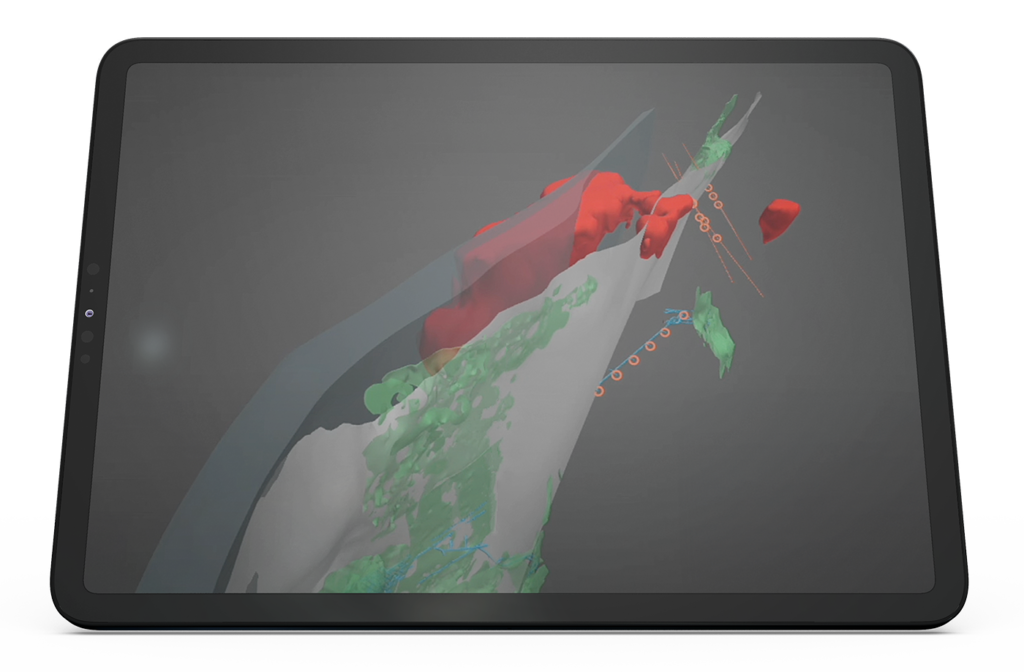
Ideon has imaged billions of cubic metres of the Earth’s subsurface – at metre-scale resolution.
Gain an unmatched understanding of the Earth’s subsurface, unlocking economic value across your operations:
See how others are leveraging
REVEAL™ for Exploration

Drill less.
Discover more.
Faster.
Provide us with some details about your exploration project and our Business Development team will be in touch.